

Three indicators that show how easy Chicago's winter has been
CHICAGO - There is just one week left of winter. Meteorological spring begins on March 1. In many ways, it feels like we have already slipped into spring.
This winter has been one of the most manageable winters we have seen on record. Let's look at three signs that suggest it's been an easy-peasy winter.
1. TEMPERATURE
Temperatures might be the best indicator of all when it comes to measuring the harshness of a winter. Normally, we would expect a nearly equal number of days with above-average temperatures and below-average temperatures. Far from it this winter.
So far, there have only been 11 days with below-average temperatures. There have been 73 days with above-average temperatures. All three months of meteorological winter will end up above average. December ended nearly 9 degrees above-average. January ended just over a degree above average. February is now running nearly 11 degrees above-average.
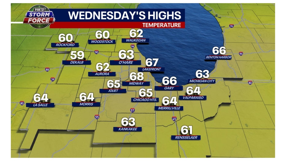
Wednesday was the warmest day of winter so far. Our high temperatures were about 25 to 30 degrees above average. They were the type of temperatures we usually see in late April or early May.
Thursday's highs were a couple of degrees cooler but still soared into the 60s for most areas.
2. ICE COVER
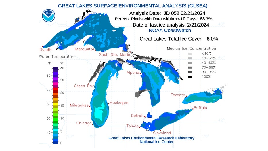
Just 6% of the Great Lakes is reporting ice cover. The historical average for this time of the year is around 40%. The ice cover is at record-low levels. Historically, the ice cover hits its peak about this time of the year.
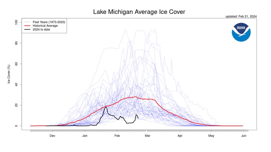
Lake Michigan's water temperature is near 40 degrees in the southern part of the lake. The ice concentration on Lake Michigan is at 8.81%, well below the average for this date of nearly 30%.
3. SNOW
Along with a lack of ice, there has been a lack of snow this winter too.
O'Hare has reported 17.3 inches so far this winter, which is more than 10 inches below average to date. December saw just 1.2 inches of snow. January has seen the bulk of snow with 16.1 inches. The snow depth of 5 inches on Jan. 13 was the most we have seen all winter. January 12th saw the highest single-day total of snowfall so far with 4.7 inches.
February has seen just a trace so far. February averages 10.7 inches. If we don't receive any more snow this month, this February will tie three others as the least snowiest February on record.
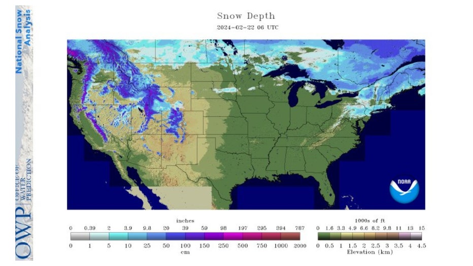
Snow cover is lacking nationally this week too. Just over 18% of the nation had snow cover on Thursday. That is down from 51.5% last month. The average snow depth is 2.7 inches. A
year ago, we had nearly double the amount of snow cover and average snow depth in the US.