Chicago snow forecast: What to expect from Friday snowstorm
CHICAGO - The calendar says spring and yet here we are, worrying about snow Friday morning.
Snow is actually not uncommon in March. In fact, one of the biggest snowstorms ever in Chicago paralyzed the city March 25-26, 1930 with 19.2".

This one will pale in comparison, but the potential for a significant accumulation may not be far away.
RELATED: Snow totals from spring snowstorm
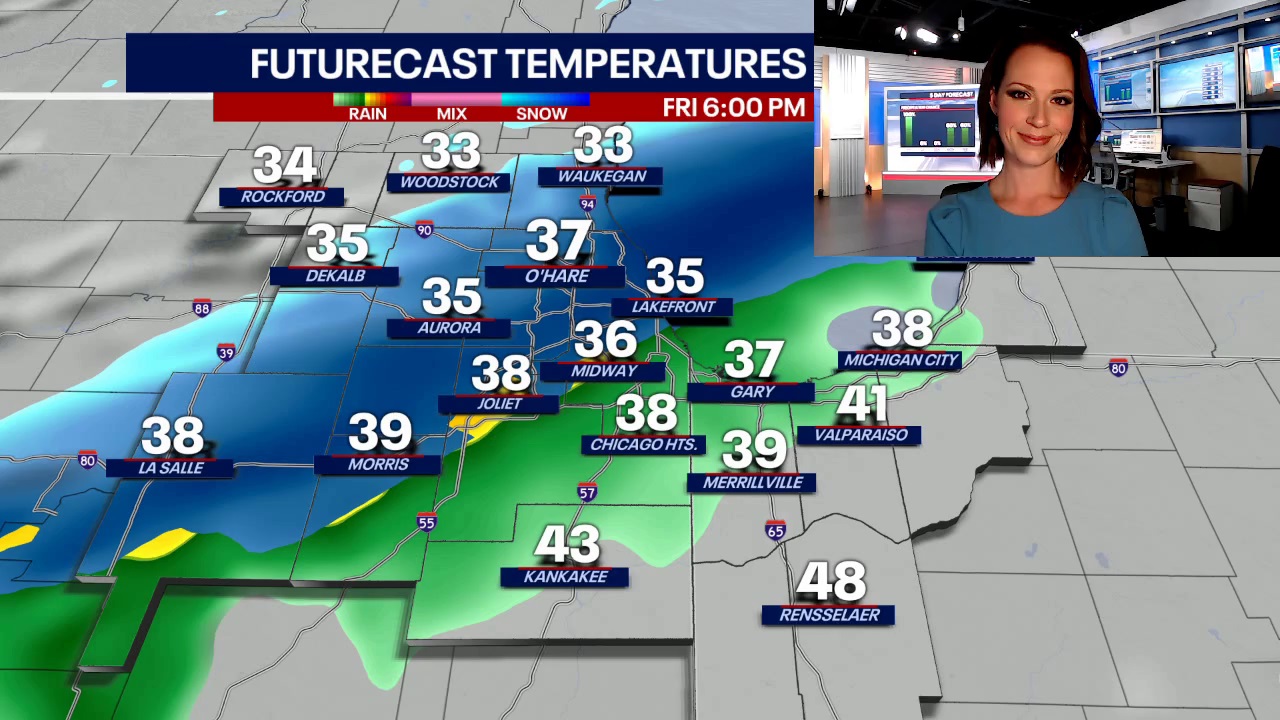
Locally, snow will begin to break out over southern Wisconsin after midnight. Snow will drift south Friday morning into the northern tier of Illinois counties.

RELATED: Chicago snow forecast timeline: Up to 5 inches possible in suburbs
While the heavier band of snow is likely to remain in Wisconsin, a slushy 1 to 4 inches of snow may accumulate in McHenry and Lake counties during the morning. This will likely impact travel in those areas. The higher totals will be close to the state line.

Farther south, temperatures will remain warm enough to prevent much accumulation even if some flakes fall.
RELATED: CHICAGO WEATHER: WHERE IS SPRING?
By midday, rain will become the dominant precipitation type in Chicagoland as a band of showers slides southeast through the area. Rain moves away before sunset.

Travel into and through southern Wisconsin will be difficult Friday where more than 6 inches may fall in a narrow stripe.

The precise track of this storm is far from locked in and even a small diversion south from the expected path could deliver more snow to Chicagoland. At this time that appears unlikely, but it will be important to monitor FOX 32 forecasts throughout the day and night for any course corrections to the storm.

Track the weather wherever you are with the FOX 32 Weather App. It's completely free and shows live radar, temperatures, incoming weather, and so much more. It also works anywhere in the world! Wherever you go, take the FOX 32 Weather App with you.


