Brace yourself for some wild December weather in Chicago
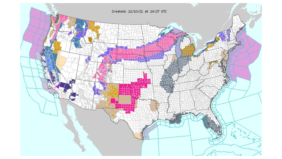
Chicago - In the course of 24 hours beginning this morning we could see everything from fog, some sun, showers, strong thunderstorms, possible tornadoes, snow to more sun. It is a smorgasbord of weather set up by a strong storm pulling out of the Rockies early Friday and moving through the Midwest tonight. At least ten states from Utah to Michigan have winter storm warnings (areas in pink on map below) for potentially heavy snow.
We will initially be in the "warm sector" of this approaching storm through late tonight. That means strong southerly winds tonight that could gust to 50 mph or more. The Storm Prediction Center has placed us in a marginal risk area for severe storms tonight into early Saturday morning. There is a slight risk for areas well south of the city and an enhanced risk for downstate Illinois.
Below is the definition of the various risk categories. A slight risk means "an area of severe storms of either limited organization and longevity, or very low coverage and marginal intensity". The greatest threat of severe weather locally is damaging winds but a brief tornado spinning up is not out of the question. The most likely window for strong storms is between 9 PM tonight and 3 AM early Saturday morning.
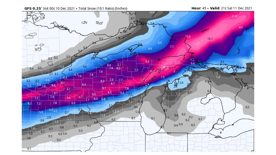
As the storm pushes northeast and away from us Saturday we will see cold air wrap around its center. This could lay down a quick coating of snow north and northwest of Chicago. Heavy snow will hammer the upper Midwest with up to ten inches possible in central and northern Wisconsin. The graphic below is the total snowfall forecast from the GFS model run out through Saturday afternoon.

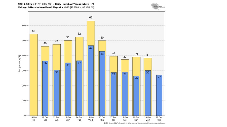
Most of this snow will melt off quickly next week as a major warm up hits. We will be flirting with record high temperatures here by Wednesday. The record high for that date is 64 set fifty years ago. My forecast calls for a high right around 64° to 65° which would be nearly 30° above average. The daily high and low forecast from the National Blend of Models below shows us warming up through Wednesday starting tomorrow.

So buckle up and get ready for a wild weather ride.


