Chicago weather: Break from the heat, but not the drought

Chicago weather: Break from the heat, but not the drought
Chicago has cooled off compared to a week ago, but no real relief in sight for the drought impacting parts of the area.
CHICAGO - Some spots will pick up a little welcome rain Tuesday with another chance coming this weekend for some precious precipitation. The kind of rain we are expecting will not put a significant dent in the drought parts of the area are experiencing.
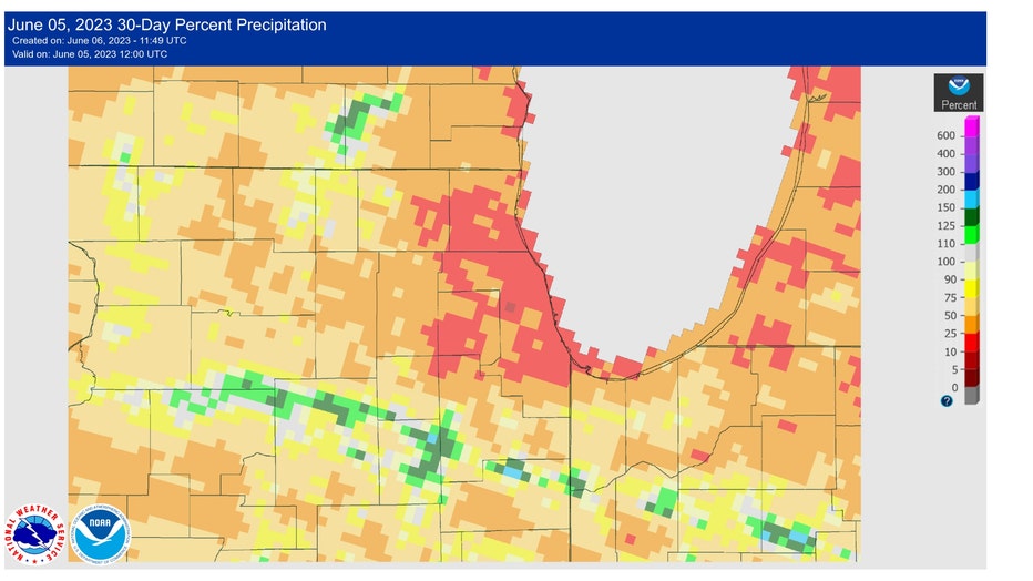
A large portion of northern Illinois and Indiana have seen between just 10% to 30% of average rainfall over the course of the past 30 days. Most of the spotty showers that will dot the area Tuesday will produce less than a quarter of an inch of rain.
The Climate Prediction Center's June precipitation outlook is not very promising.
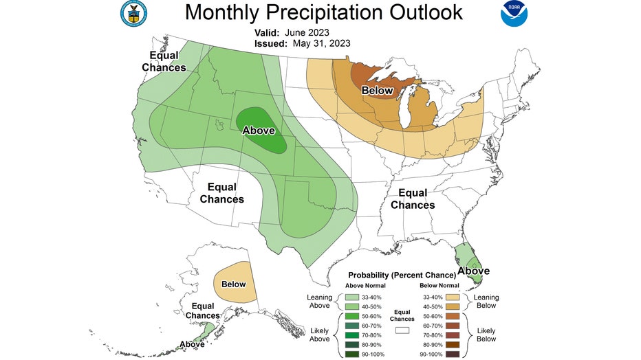
The outlook has us "leaning below" average overall for the month of June. Last month ended up being the fourth-driest May on record.
June started off with some hope. O'Hare picked up .88" of rainfall on the first day of the month. The last time we saw more than a half inch of rain on a single day was back on April 4.
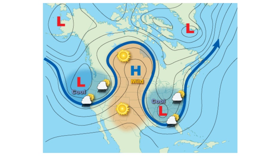
"Omega Block" pattern
A "Rex Block" pattern recently kept us rain-free for an extended period. Now we are experiencing an "Omega Block" pattern. A ridge of high pressure at the jet stream level is squeezed on either side by low-pressure systems. This has effectively bottled up the mechanism for moving weather systems across the country. The air will be sinking and drying out under the ridge, where we will find ourselves for at least a few more days.
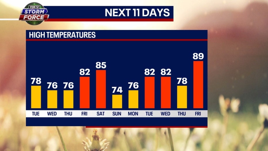
Not much rain in our forecast and certainly no extreme heat. Our Fox Model 11-day high-temperature forecast has highs spiking into the 80s Friday and Saturday and then again towards the middle of next week. The hottest day during this period is forecast for a week from Friday when highs hit near 90.
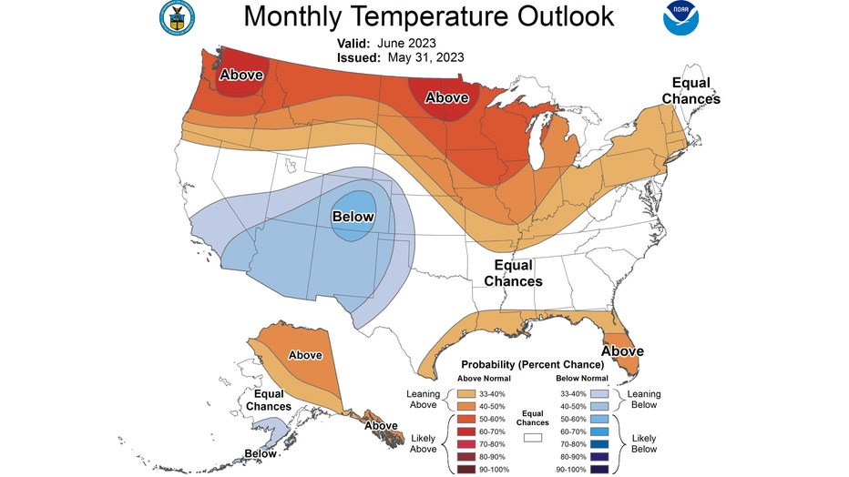
The Climate Prediction Center's monthly temperature outlook hints at possibly more heat returning at some point this month. It has our area either "leaning above" or "likely above" average overall for the month of June.

