

Chicago weather: Timeline as severe storms threaten again after widespread derecho damage
Another round of severe storms threatens Chicagoland after widespread derecho damage
Mike Caplan has your Chicago weather update!
CHICAGO - That was a wild one yesterday and, unfortunately, it looks like we’ll be going through another dangerous situation late this afternoon and early tonight.
As of this writing, there are still about a quarter million people without power in Chicagoland. I have no qualms about calling Wednesday's storm system a derecho. That’s because a nearly-continuous swath of damage reaches from eastern Iowa across northern Illinois, southern Wisconsin, and northern Indiana. That's more than long enough to qualify as a derecho with the added fact that several instances of hurricane-force winds were reported.
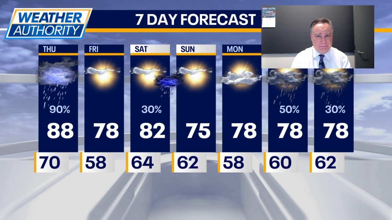
Now, let’s deal with today’s worrisome weather. The morning should be quiet with temperatures quickly climbing thanks to some peeks of sunshine. It will be quite humid once again and high temperatures will reach the mid 80s to perhaps 90° in our viewing area.
Similar to yesterday, we will likely have two rounds of storms. First will be a cluster of thunderstorms arriving during the early afternoon. There is a chance they will be weakening, but there is also a chance they won’t. Damaging winds would be a primary threat if this round maintains its strength coming out of Iowa. Regardless, that is not the "show" that will arrive very late in the afternoon and early tonight with 5 to 10 p.m. being prime-time. All hazards are in play, with a significantly greater chance of tornadoes than what we had yesterday.
Once again, damaging straight line winds will be the most widespread impact. Large hail is also on the table, much more so than yesterday. Because the storms will be moving very quickly, widespread flooding is not expected. However, there can certainly be some quick ponding on roadways. In our southern viewing area where heavy rain fell yesterday, there might be a small chance for some localized flooding concerns.
The message once again is to be "weather ready" this afternoon and evening.
Featured
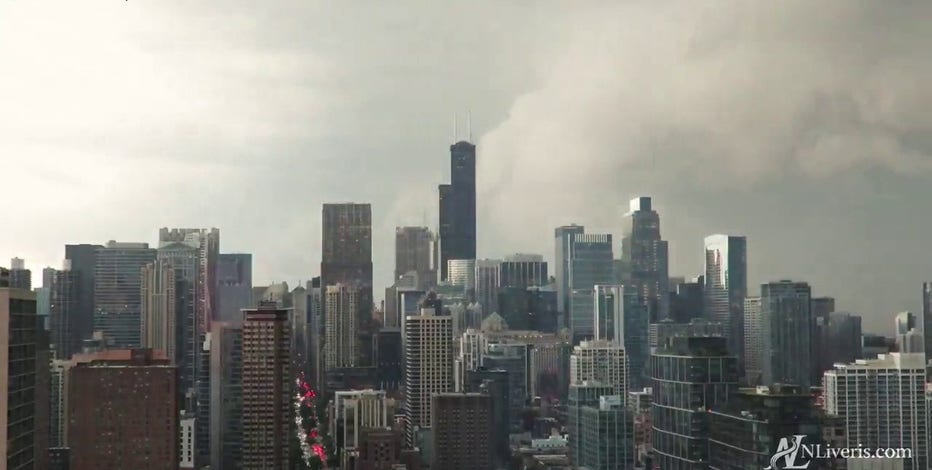
Video shows powerful storms roar through Chicago; nearly 200K without power as cleanup begins
Timelapse video captures the moment a powerful line of storms barreled through downtown Chicago on Wednesday. The system reportedly produced hurricane-force wind gusts and left behind widespread damage and power outages.
What's next:
After the storms move out, we will have a couple of quiet days on Friday and most of Saturday. Highs tomorrow will be in the upper 70s and lower 80s with noticeably lower humidity.
Saturday will be warmer with highs in the mid 80s and, just like Friday, it will be mostly sunny. Late in the day and at night, a cold front will spark strong thunderstorms. In their wake, a refreshing air mass arrives Sunday with highs in the mid 70s and comfortable humidity.
The Source: The information in this forecast came from FOX Chicago's Mike Caplan.