Chicago expecting first snowstorm of the season

Tim's Weather Takeaways: Winter had to come sometime
Chicago has been spared heavy snow and bitter cold so far this winter, but that's all about to change as a big storm system heads for northern Illinois.
Chicago - This winter is about to take a turn for the worse in Chicago. First comes some snow that will eventually be followed by frigid air.
The biggest snowstorm of the season so far will begin to impact the area starting Monday night and may linger as long as Wednesday morning.
Snowstorms in January should not surprise anyone. Five of the worst ten snowstorms in Chicago's history took place during the month of January. The all-time worst snowstorm in Chicago's history occurred from Jan. 26 through the 27 when 23 inches of the white stuff fell. This week's storm won't crack the top ten list but will slow everyone down at the very least.
SCHOOL CLOSINGS: Complete list of Chicago area school closings
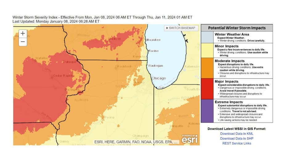
NOAA's Weather Prediction Center suggests the storm will have minor to moderate impacts here. Minor impacts are expected for most of the Chicago area which means driving with caution. Moderate impacts are expected for areas west and northwest of Chicago, which means disruptions to daily life, hazardous driving conditions, and possible closures and disruptions to infrastructure.

Winter Storm Warnings were posted for the far northwestern suburbs, including DeKalb, Lake, and McHenry counties, until 12 a.m. Wednesday. This is the area expected to receive the heaviest snowfall amounts. Snow totals here could exceed half a foot.
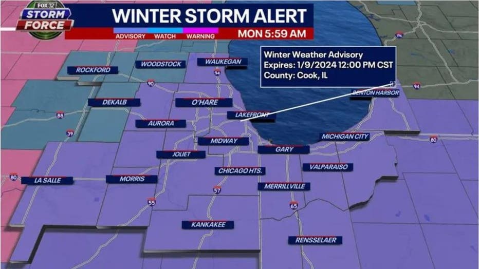
Winter Weather Advisories were posted for most of the area until noon Tuesday. A few to five inches of snow is expected for these counties.
The bulk of the snow will fall within a window from after midnight to before daybreak. Snowfall will range from around 1 inch north of the city to possibly 4 inches well south of the city by around daybreak Tuesday. It could come down at the rate of an inch to two inches per hour. Strong winds will accompany the snowfall. Gusts could hit 35 mph at times. A second round of snow will primarily impact our far northwestern suburbs from Tuesday afternoon into Tuesday evening. That is where several additional inches could fall.
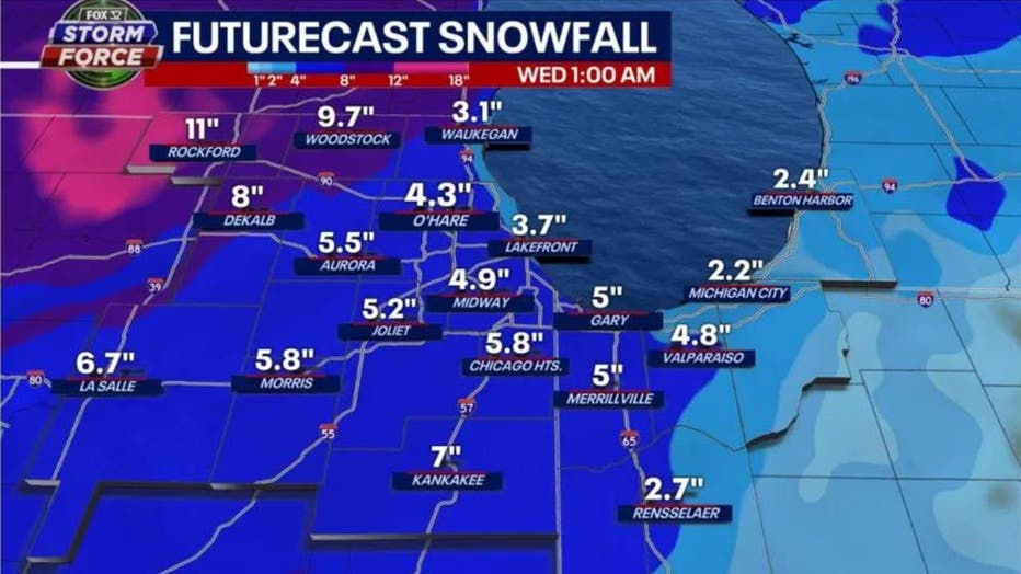
Our Baron Model spits out a grand total of about 3 to 10 inches through Wednesday morning. Most of us would receive about 3 to 6 inches according to this model, with the heaviest amounts, 6 to 10 inches, in our far northwestern suburbs.
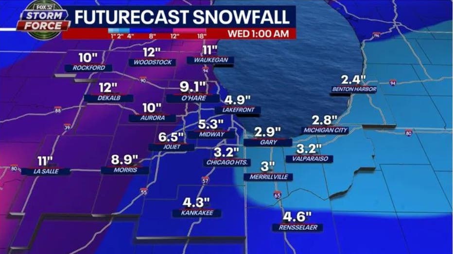
The GFS model has similar snowfall numbers but brings heavier amounts further east than the Baron Model. This model squeezes out 9 inches to nearly a foot in total from a line running through O'Hare and Morris and areas north and west of there. It will be heavy, wet snow.
Another round of snow is possible Wednesday night into early Thursday. Only minor accumulations are expected at this time. More snow could come Friday night into Saturday. This system will drag bitterly cold air in behind it. The longer-range temperature outlooks from the Climate Prediction Center bring a bullseye of blue to the Midwest. This will be the coldest air of the season so far.
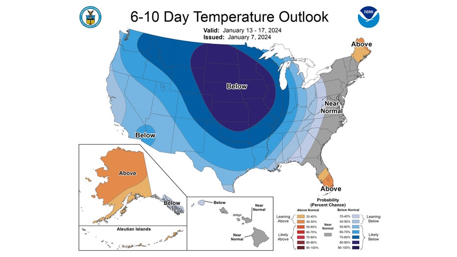
The 6-10 day temperature outlook forecasts northern Illinois and Indiana to be "likely below" normal overall. This covers the period from next Saturday through the following Wednesday.
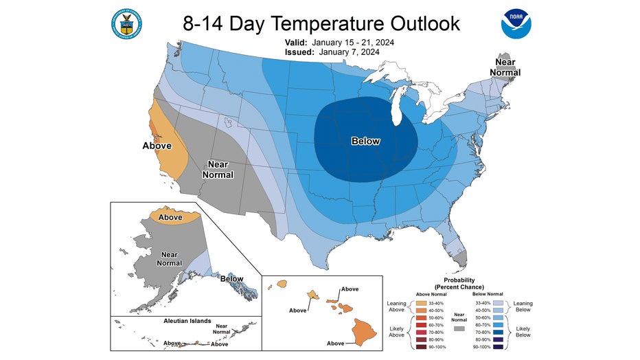
The 8-14 day temperature outlook also has us "likely below" normal overall. This covers the period from next Monday through the following Sunday. The GFS model is forecasting frigid highs Sunday through Tuesday only in the single digits with wind chills well below zero at times.
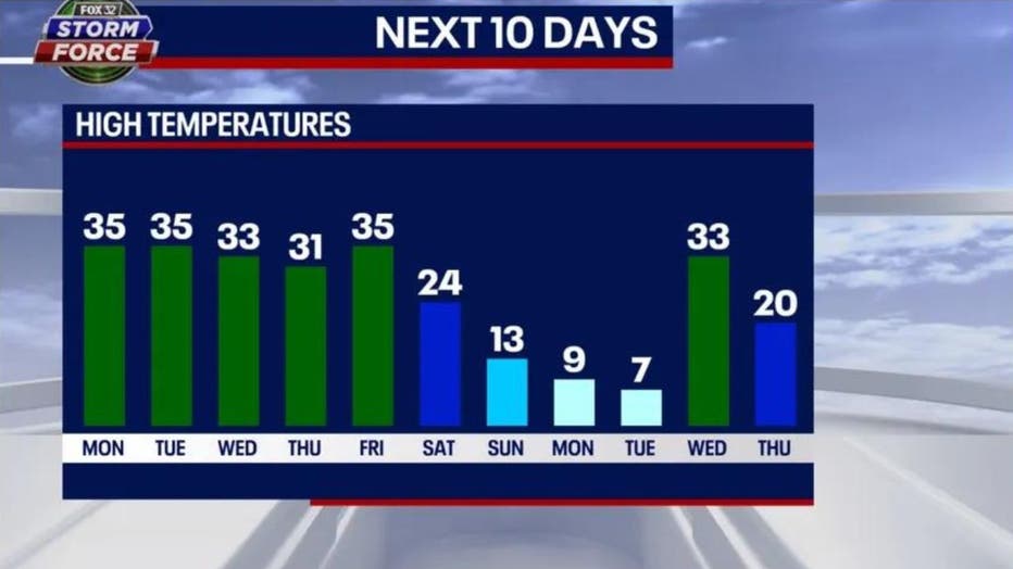
The bottom drops out with our long-range Fox Model forecast. It has highs dropping into the teens by Sunday with single digit highs Monday and Tuesday. This means bitter cold following several inches of snow collectively over the next five days. Welcome to winter in Chicago.

