Chicago's first 'spring' snow is coming, falling heavily in some places

Chicago's first "spring" snow is coming, falling heavily in some places
Spring starts Wednesday but wintry weather is on the way for Chicago.
CHICAGO - Meteorological spring has started! We already have our first "spring" snow of the season on the way. Spring may be trying to make up for winter's lack of snowfall. O'Hare picked up 16.8" of snow from December through February. That was more than a foot below average. We saw around 57% of average snowfall for the winter of 2022-2023. It will rank as the 30th least snowy winter on record.
It's hard to get snow with the kind of temperatures we saw the past three months. This past winter will rank as the 14th warmest on record. Spring is starting off much warmer with a high on Wednesday that should be more than 10 degrees above average. Cold air is coming though for the end of the week and that cold will coincide with a storm pulling up moisture from the south.
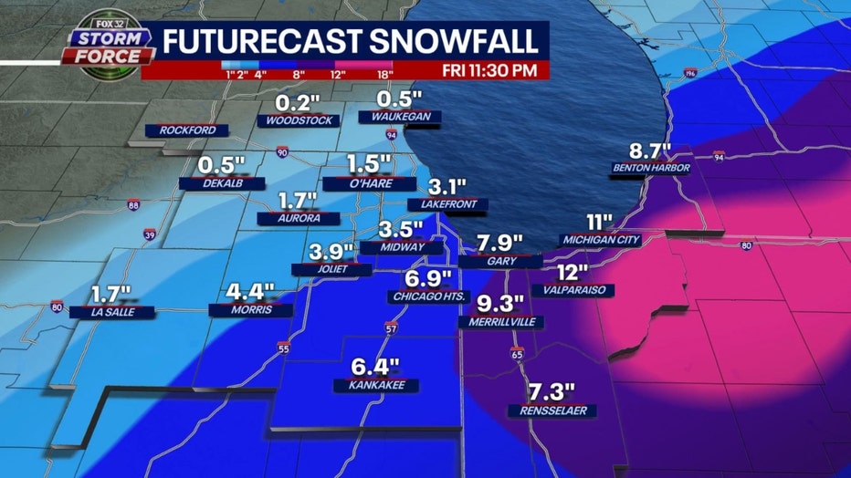
I will share some computer model forecasts for Friday's snow but keep in mind this is still fairly preliminary. The storm track and other factors will determine where the heaviest swath of snow will lay out so stay tuned. Some of this will start off as a mix of rain, freezing rain and snow so that will also affect the amounts of snow that we ultimately end up seeing.

GFS model total snowfall accumulation forecast thru Friday night
The GFS model squeezes out a wide range of snow from as little as a dusting well northwest of Chicago to around 3-4 inches in the city. The heaviest snow is south and east of Chicago where up to a half foot to a foot could come down.

Baron model total snowfall accumulation forecast thru Friday night
The Baron model's numbers also suggest the heaviest snow will generally be south and southeast. It brings the heavier snow near the city (8 to 11 inches) and south and east into northern Indiana where up to nearly a foot of snow would fall. Snowfall amounts taper off from around 6 inches at O'Hare and our northwest suburbs to under an inch well northwest of the city.
The main message here is impactful snow will fall for a large portion of the Chicago area. Models are in general agreement it will start early Friday with minimal impact on the morning commute but the brunt of this will come later Friday. The evening commuted will be most impaired.

Temperature will take a typical rollercoaster early spring ride through next week. Today will be the warmest day of the next eleven before we turn colder tomorrow and Friday. We warm back up for the weekend and then turn colder again for the end of next week. Six of the next eleven days will be below average.
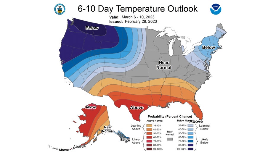
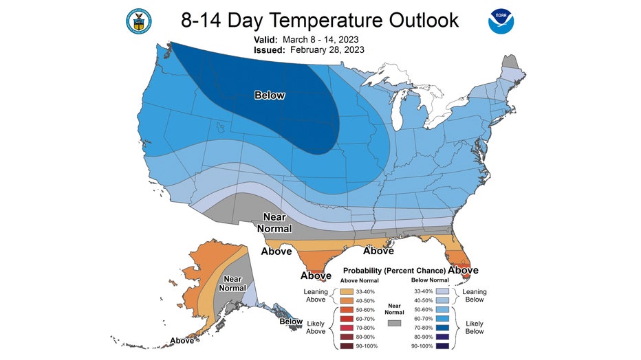
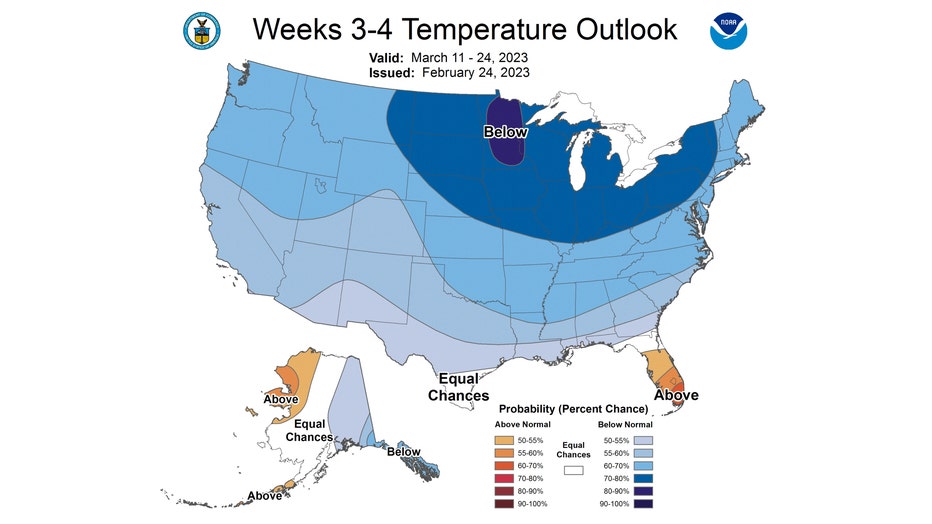
The Climate Prediction Center's long-range temperature outlook takes us from around average temperatures to a colder than average period overall for the middle and end of March.

The 6-10 day temperature outlook has us "near normal" overall from Monday through Friday next week.

The 8-14 day temperature outlook brings the blue shades from the western part of the country eastward and southward. The Midwest along with most of the country is expected to be below average overall as a colder pattern kicks in. We are outlooked to be "likely below" average from next Wednesday through the following Tuesday.

The longer range 3-4 week temperate outlook continues this colder pattern for most of the country from March 11th through the 24th. More good news possibly for snow lovers. Don't forget we average nearly 6" of snow for the month of March.

