Chicago's sunny, hot weather comes with a cost

Chicagos sunny, hot weather comes with a cost
Chicago is stuck in a meteorological rut. The weather pattern started off with sensational weather last week, but we are now paying the cost for this prolonged period of sunny, dry weather.
CHICAGO - We are almost in the middle of what could be the warmest streak of weather Chicago has seen since the end of July and the start of June last year.
Wednesday will be the fourth straight day with a high in the 80s or warmer. It is possible there could be another six straight days just as warm still to come. That would make 10 days in a row with highs in the 80s or warmer and that hasn't happened here for nearly 10 months. The high of 91 degrees on Tuesday was the hottest since August 6 of last year.
There is an atmospheric bottleneck that has kept us stuck in a weather rut that has meant some beautiful weather, at least until Tuesday. A "Rex Block" pattern set up shop in the southeast several days ago. This pattern is categorized by a strong high-pressure system sitting north of a deep low-pressure system. Weather under the high-pressure system is clear and dry while wet weather is found underneath the low-pressure system. The low-pressure system was slowly moving through the Tennessee Valley region over the weekend as we were firmly entrenched under a ridge of high pressure.
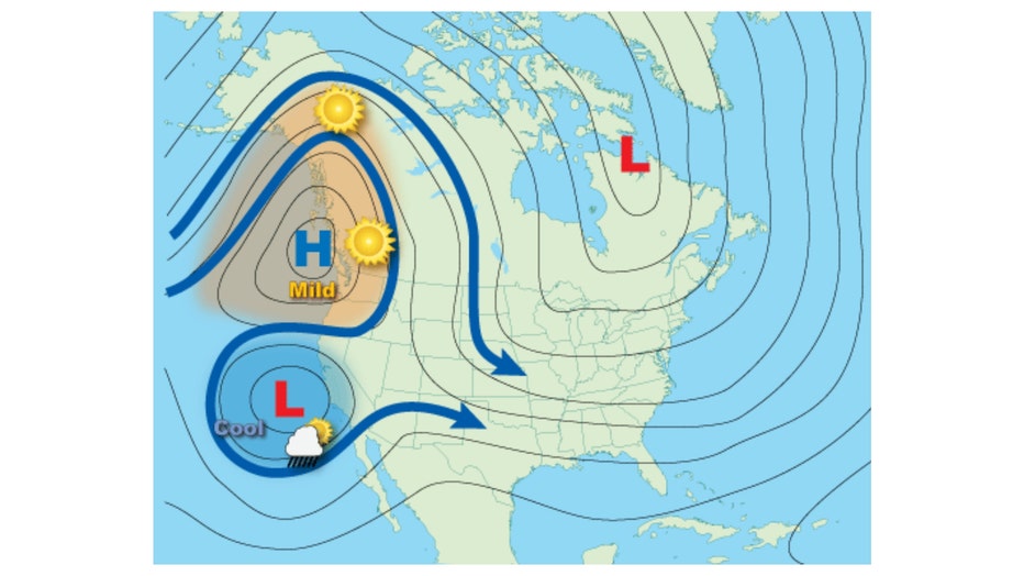
"Rex Block" weather pattern.
When this pattern first developed, we were enjoying wall-to-wall sunshine, mild temperatures, and low humidity. The ridge of high pressure over us has begun to trap some pollutants at the surface and that led to the first air quality alert for the Chicago area of the season on Tuesday. No alerts Wednesday, but they are in effect for much of Wisconsin and western Michigan.
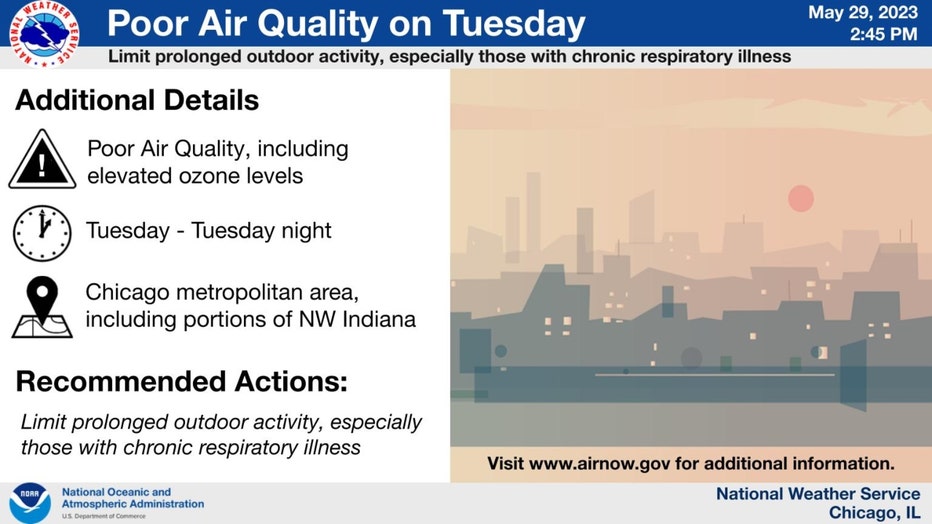
This same pattern has also contributed to the U.S. Drought Monitor declaring a moderate drought for most of the city and several suburbs. The drought has most likely deepened and expanded since last week's update. We are down nearly four inches below average of rain for the month of May.
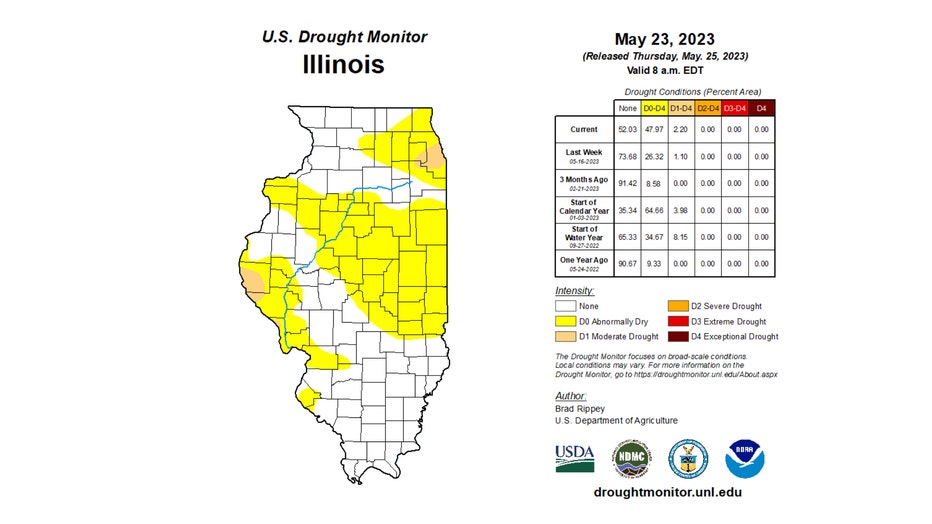
A large portion of Cook County along with portions of DuPage and Will Counties are in a moderate drought.
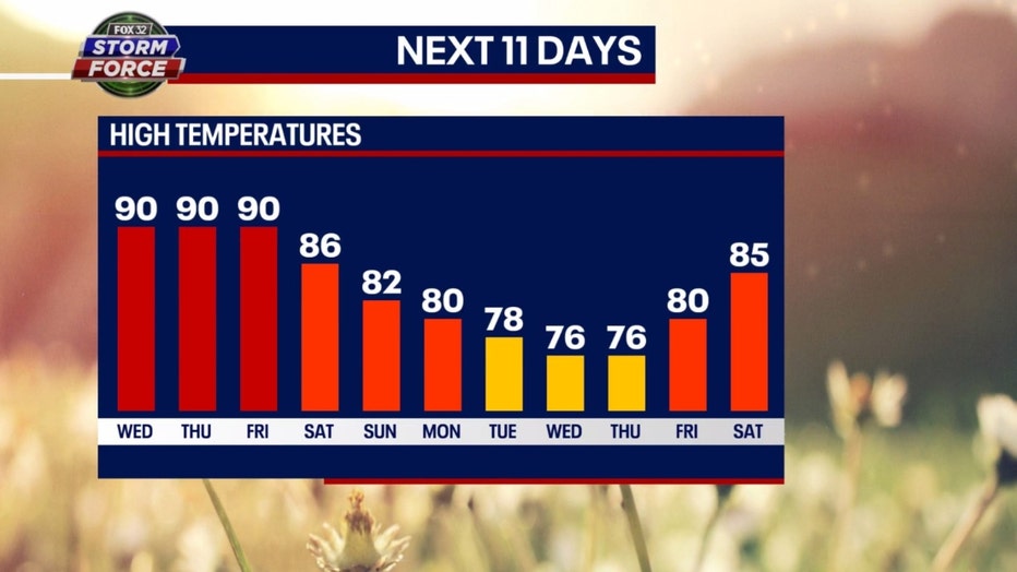
Our Fox Model keeps the 90-degree heat coming through Friday. We "cool off" over the weekend with highs hitting the 80s then they slide into the 70s for the middle of next week. Average highs this time of the year are in the middle 70s.
The longer-range temperature outlook from the Climate Prediction Center suggests a warm pattern for next week.
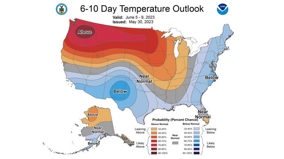
The 6-10 day temperature outlook has us "leaning above" normal from next Monday through the following Friday.

