

Chicago weather: A toasty transition from September to October
Chicago weather: A toasty transition from September to October
The latest longer-range forecasts strongly suggest a warmer-than-average end to September and start to October.
CHICAGO - So far, so warm this year for Chicago.
Seven of the first eight months of the year have been above average. September should end above average making it the sixth straight month to do so. Despite 13 straight days below average earlier this month, September is still running above average overall.
Monday was our sixth straight day with above average temperatures and the month is now running 2.4 degrees above average. Chicago is now running three degrees above average through August making this year-to-date the third warmest in 65 years.
The latest longer-range forecasts strongly suggest a warmer-than-average end to September and start to October.
Our Fox Model has eight of the next 10 days coming in above average. The forecast has a streak of five straight days with highs of 80 degrees or warmer. It will feel less like fall and more like summer during the period.
The longer-range temperature outlooks from the Climate Prediction Center also strongly suggest a warmer than average pattern for the next couple of weeks. Average highs for the end of September slide to 69 degrees and average highs at the start of October are in the middle to upper 60s.
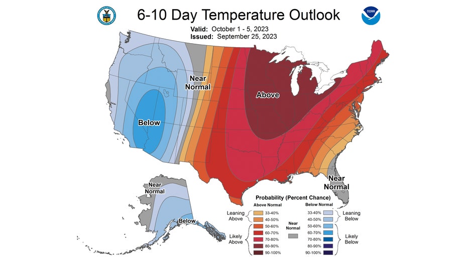
The 6-10 day temperature outlook has us "likely above" normal overall from this Sunday through the following Thursday. The bullseye with the highest probability range of this occurring is centered right over the Midwest. There is an 80 to 90 percent probability of this happening.
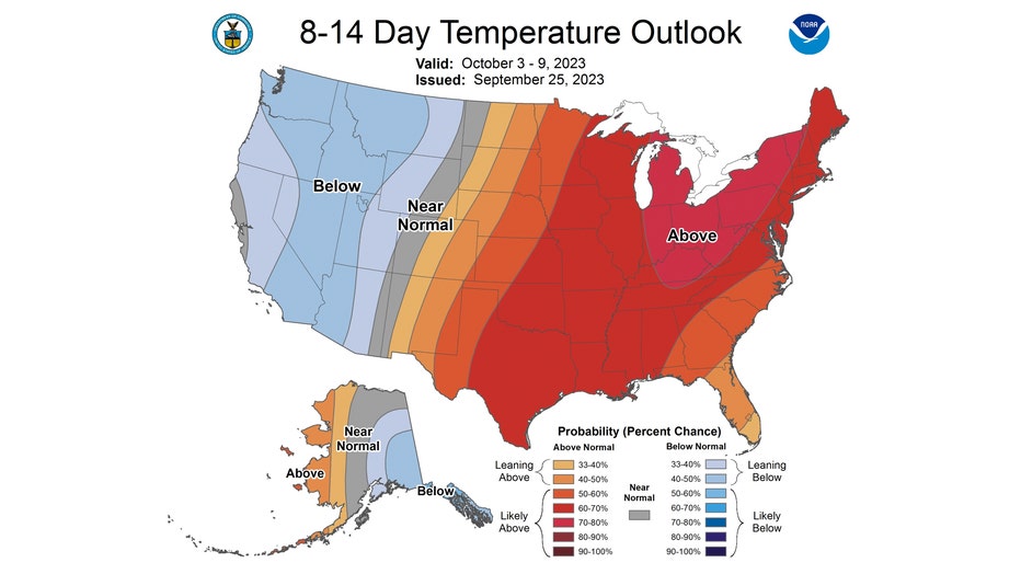
The 8-14 day temperature outlook also has us "likely above" normal overall from next Tuesday through the following Monday. Still a fairly strong signal, although the probabilities fall to 60 to 70 percent. There is a chance a warmer than average pattern could be around for the next season too.
There are some early indications we could be in for a warmer-than-average winter too. Our now moderate El Niño is expected to strengthen over the coming months. An El Niño means warmer than average equatorial sea surface temperatures in the eastern Pacific Ocean. There is a greater than 95% chance it will continue through the winter according to NOAA. Most models have the event persisting through the spring of next year.
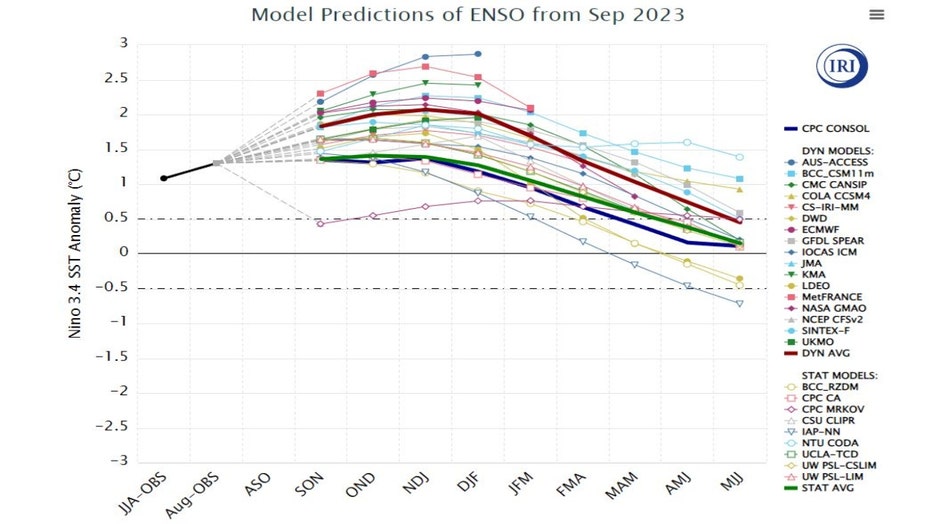
Most models have it peaking November-January with nearly all the models expecting a moderate-to-strong El Niño. An El Niño is an example of a "teleconnection". NOAA's definition of teleconnections is "significant relationships or links between weather phenomena at widely separated locations on earth."
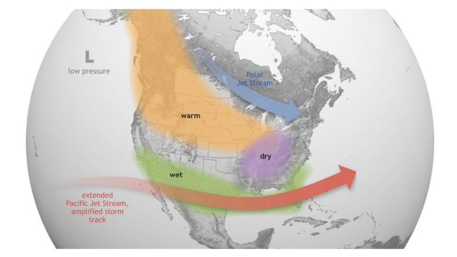
An unusually warm pocket of water in the eastern Pacific tends to favor us for above-average temperatures overall during winter. Its influence on precipitation here is more tricky to pin down. A warmer than average El Niño winter tends to produce around average or a bit above average precipitation, but some of that precipitation can take the form of rain rather than snow.
El Niño's winter weather impacts.
The official NOAA winter forecast will be issued in October so stay tuned!