Tim's Weather Takeaways: Wintry blast won't last
Chicago - Baby, it's cold outside but it won't last very long.
After six straight days with above average temperatures we turn quite a bit colder today with the worst of the cold this week coming tonight and tomorrow. O'Hare's high for Monday was 38° at midnight but temperatures will tumble through the day.
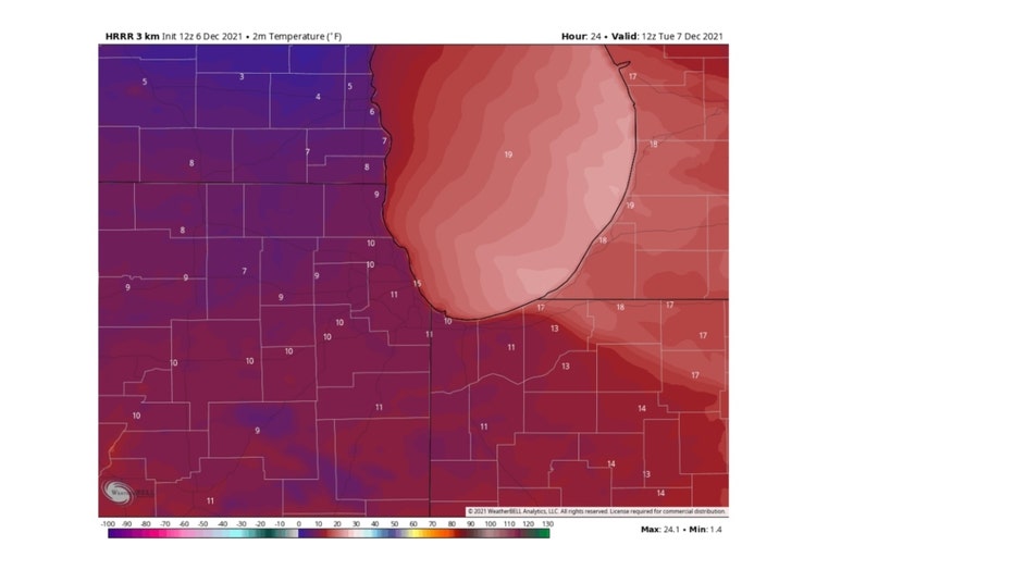
The HRRR Model has our lows dropping tonight into the single digits north and northwest of the city. It should be the coldest night in a little over ten months. We have not been this frigid since February.
DOWNLOAD THE FOX 32 CHICAGO WEATHER APP FOR THE LATEST FORECASTS
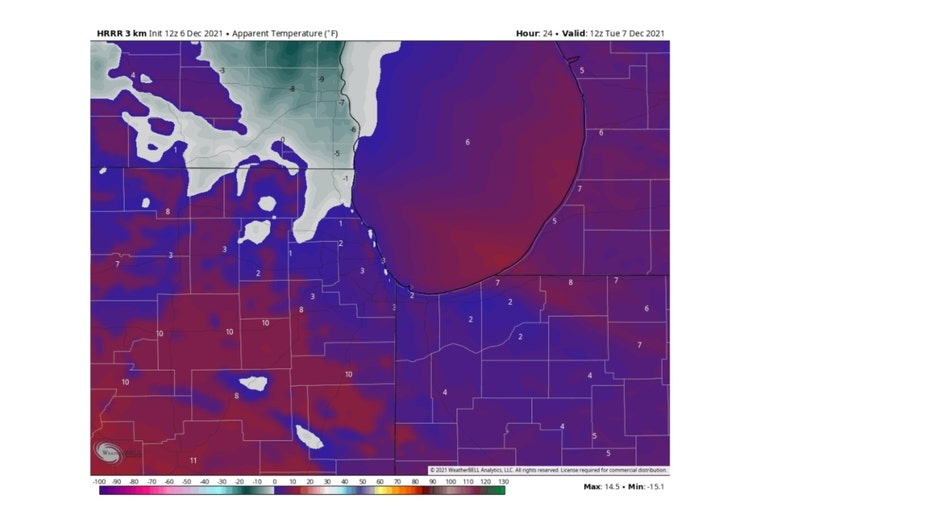
Today's gusty winds will subside a bit tonight but still manage to make for some bitter wind chills. They could dip below zero overnight north and northwest of Chicago. The HRRR Model apparent temperature forecast shows subzero wind chills in parts of Lake, McHenry, Kane and even northwest Cook county.
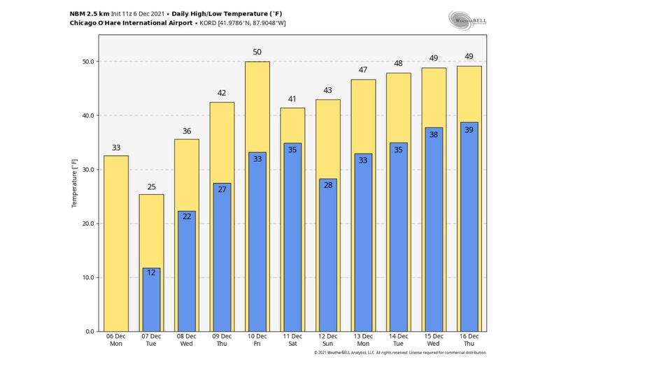
The National Blend Of Models shows Tuesday's highs in the middle 20s will be the coldest in at least ten days and probably beyond. We could warm back to 50° by Friday. Average highs for this time of the year are in the upper 30s. Even though we turn a bit colder after Friday we stay above average through Thursday next week.
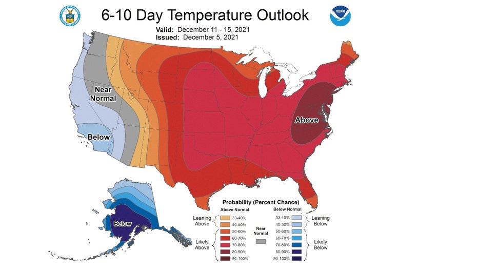
The longer range temperature outlooks have a strong signal for a warmer than average patten overall through the middle of the month. The 6-10 day outlook shows most of the country favored for above average temperatures overall from this weekend into the middle of next week.
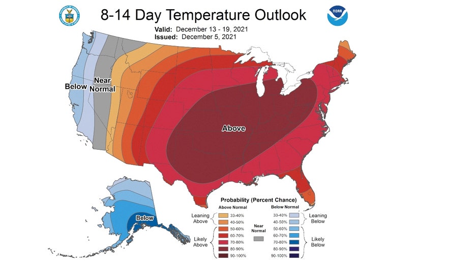
The strong warm signal continues in the 8-14 day outlook. This covers the period from next Monday through all of next week.
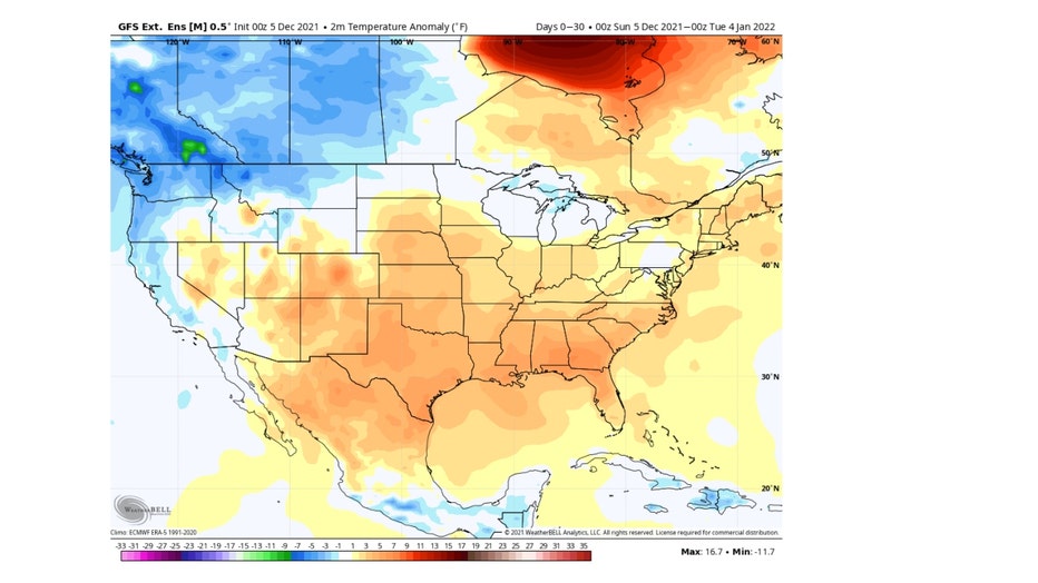
The even longer range temperature outlook from the Global Ensemble Forecast System (GEFS) keeps the milder pattern coming all the way into the first few days of January. It has northern Illinois about 1° to 2° above average overall.
So bundle up for today, tonight and tomorrow and then enjoy the thaw that comes later this week.


