First came the cold and now comes the snow for Chicago
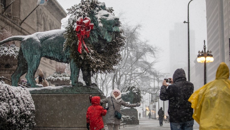
A woman poses in front of the lion at the Art Institute of Chicago in downtown Chicago, the United States, on Jan. 1, 2022. (Vincent D. Johnson/Xinhua via Getty Images / Getty Images)
CHICAGO - The first 11 days of November were well above average, even as much as over 24 degrees above average. The streak of consecutive above average days that started in late October stretched to 15 days before ending on Saturday. Monday will be our third straight day below average. It looks like we could add at least another 10 consecutive colder than average days in a row to that streak.
If the cold isn't enough of an early taste of winter, how about some snow? Our first measurable snow of the season is scheduled to arrive Monday night and linger into at least early Tuesday. This first real sticking snow of the season is almost right on schedule. The average first date for a tenth of an inch of snow or more is November 14.
First snows of the season are notoriously difficult to predict when it comes to amounts. The ground temperature along with the possibility of some snow mixing with or changing to rain are just a few challenges forecasters face. A wind off a relatively warm Lake Michigan can also eat into the snowfall totals.
SUBSCRIBE TO FOX 32 CHICAGO ON YOUTUBE
Our proprietary Fox Model is laying down about one to three inches of snow by Tuesday evening. It hints at higher amounts along and south of I-80 where more than three inches could fall in spots.
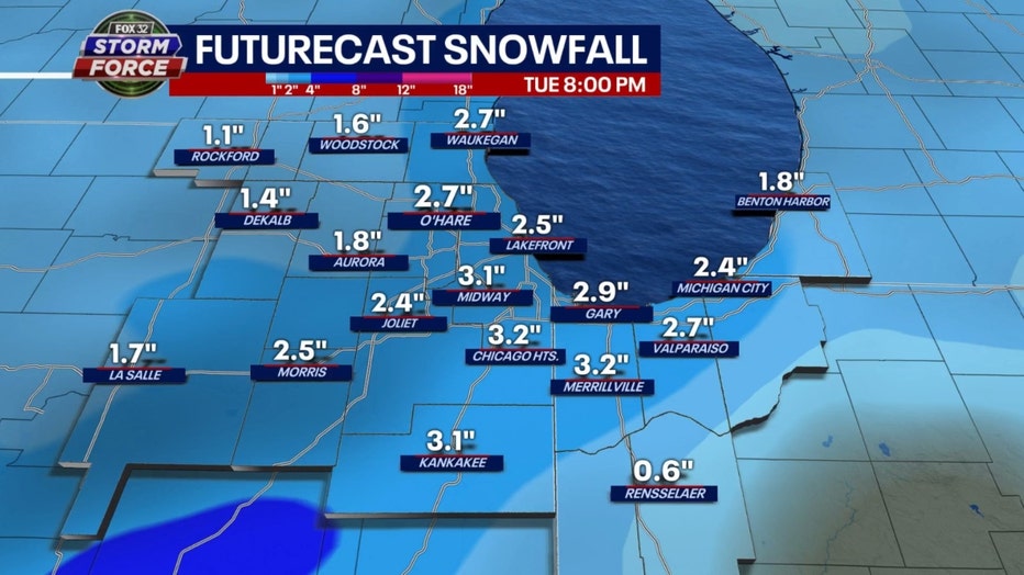
Fox Model
Our Baron model is showing similar snowfall amounts. One to three inches is the most likely range of snowfall but a few spots south of the city could see nearly four inches in total.
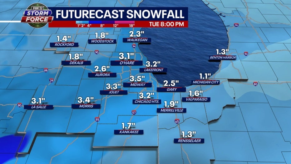
Baron Model
Our colder pattern could continue through at least Thanksgiving weekend. Our model shows below average temperatures (by as much as 20 degrees) through a week from this Thursday. Average highs for this time of the year are in the lower to middle 40s.
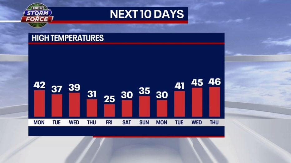
This cold pattern could continue well into November. The longer range forecasts from the Climate Prediction Center still have lot of blue on them. That color signifies portions of the country forecast to be colder than average.
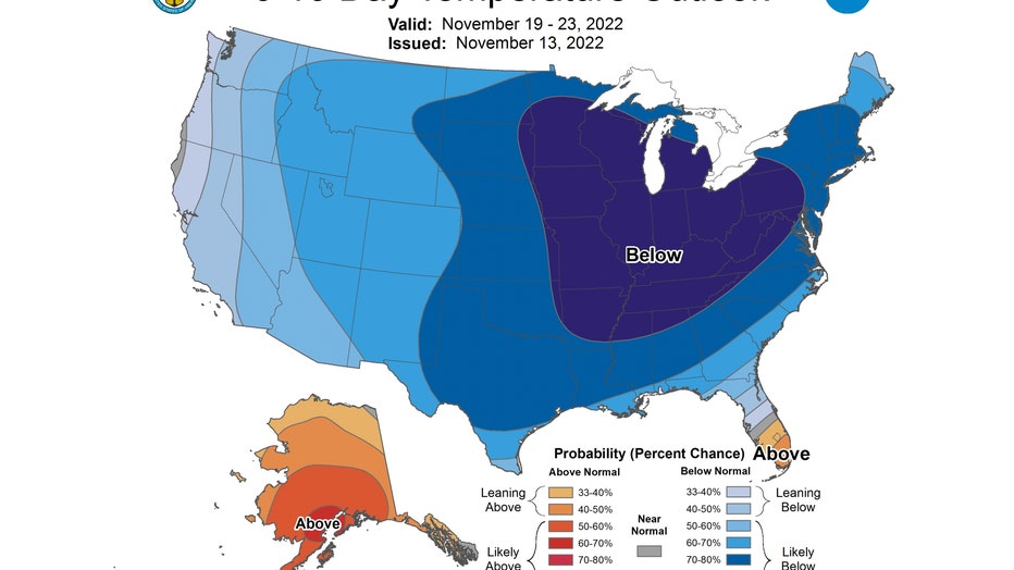
The 6-10 day temperature outlook has us "likely below" average from next Saturday through the following Wednesday. The coldest part of the forecast seems to be centered right over Chicago.
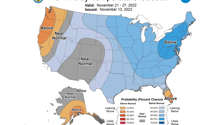
The 8-14 day temperature outlook also has us in the "likely below" average category. This covers the period from next Monday through the following Sunday.
Welcome to early winter.

